
Wind Farms
AVISTEP - the Avian Sensitivity Tool for Energy Planning
In 9 countries each 5km x 5km cell within the heatmaps has a sensitivity score.
Learn more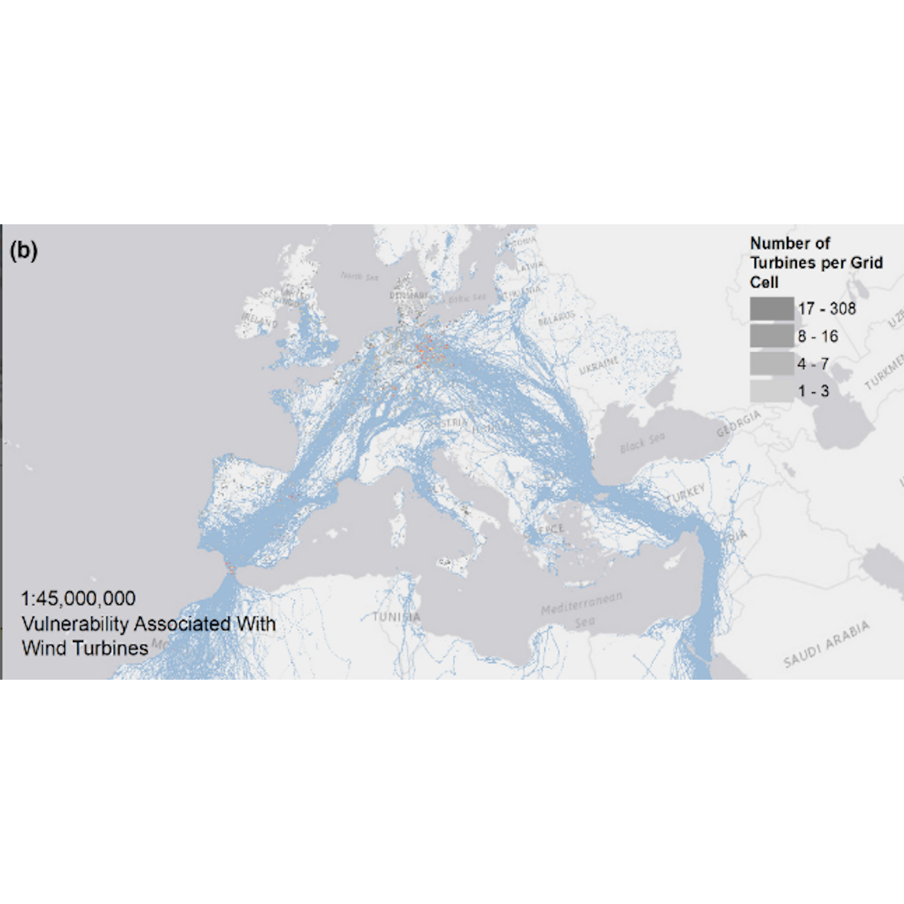
Avian vulnerability to collision risk from wind turbines in Europe and North Africa
[Datasets and Shapefile available on Dryad]
Download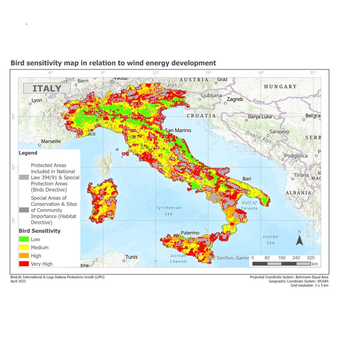
Bird sensitivity map in relation to wind energy development in Italy
Map produced in collaboration between BirdLife International and LIPU
Request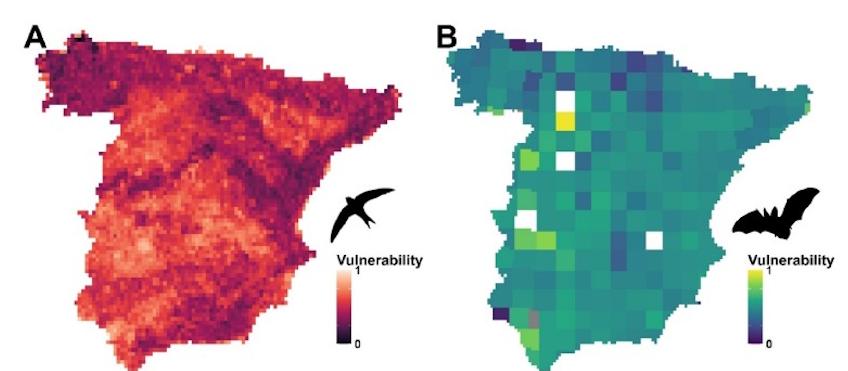
Vulnerability of bird and bat assemblages to help understand the potential impact of wind energy development
Map obtained from Morant, et al. (2025). Mapping bird and bat assemblage vulnerability for predicting wind energy impact. Journal of Environmental Management, 380, 124961.
Shapefile Morant et al 2025 bats & birds available on Figshare
Download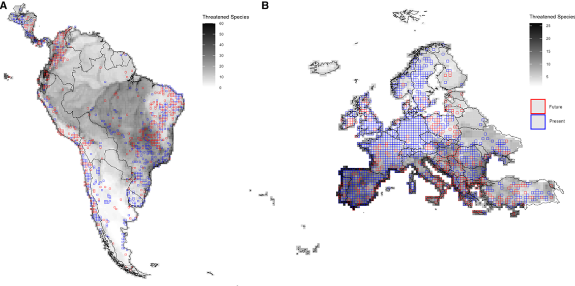
Associations between renewable energy generation and other human-induced threats to terrestrial biodiversity.
Gorosábel et. al. (2026). Assessing the associations between renewable energy generation and other human-induced threats to terrestrial biodiversity. Cell Reports Sustainability.
[Datasets and Shapefile available on Zenodo]
Download